The equipment has already been used to map several hiking trails, including the Grand Canyon, and in the UK the complex network of canals and waterways that runs up and down the country has been recorded.
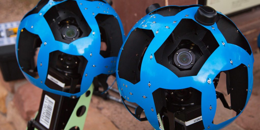
Making maps – Google is very selective when it comes to imagery and aims to capture photographs when the weather is clear and the view is unobstructed. Images are recorded alongside GPS information so their exact location is accurately mapped. The camera technology uses a series of lasers to measure the distance from the lens to the image subject, creating 3D models of the landscape. This enables the best image to be selected depending on where the user ‘stands’ in Street View.
Pages: 1 2


Leave a Reply